Zambia
- General Information
- Capital
- Administrative Division
- Geography
- Climate
- History
- Economy
- Tourist Attractions
 General Information
Country:The Republic of Zambia(nick name Copper country)
Population: 13,047,000 (2010) and 73 tribes, mostly Bantu blacks
Religion: 72% population Christian and the rest in primitive religion
Language: English the official language and other 31 tribal languages
Currency: Zambian Kwacha
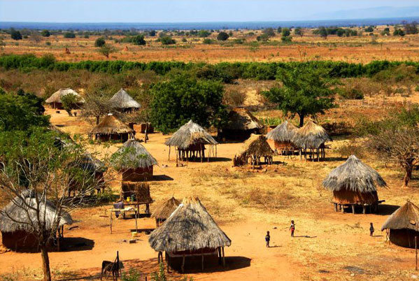
Lusaka is the largest city with the population of 2 million and located on land south-central plateau with an average altitude of 1280 meters. It also is a national industrial, commercial and important agricultural distribution center. Lusaka lies as a national transport hub at the intersection of Tanzania's big north road and Malawi's big east road.
It is called “the copper capital” because of its rich copper mine. Kafue large hydropower more than 20 kilometers southwest of the downtown stands with a generating capacity of 600 thousand kilowatts.
The country is divided into nine provinces
Central Province
Copper belt Province
Eastern Province
Luapula Province
Lusaka Province
Northern Province
North-Western Province
Southern Province
Western Province
An area of 752,614 square kilometers. Landlocked country located in south-central Africa. Northeast neighbouring Tanzania, the east side border on Malawi, the southeast is connected with Mozambique, south meets Zimbabwe, Botswana and Namibia, west side is Angola, north by Congo (gold), Tanzania.
The whole territory is divided into five areas according to topography:Northeastern part the East Africa Great Rift Valley area,the northern Katanga Plateau, the Kalahari Basin in the southwest, southeast Luangwa - Malawi Plateau and the Central Luangwa river basin area.
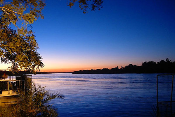
Northeastern border Ma Fenjia mountain 2164 meters above sea level, the country's highest point. Zambezi River flows through western and southern,have the famous Victoria Falls. Congo River (Zaire River) originates upstream of Luapula Province.
Zambia has a tropical climate, because the plateau at an altitude of 1,000-1,300 meters, low humidity, compared to other tropical African countries, relatively cool temperatures. Local following three seasons: dry and cold season May-August,15.6-26 .7 ℃. Dry-hot season :September-November,26.7-32 .2 ℃. Hot and humid season :Decemember-April,26.7-32 .2 ℃, the rainy season. The national average annual rainfall of 1,270 millimeters, 760 millimeters around the capital Lusaka. The whole year might put on the summer clothing to cross, but when did the cold season the temperature difference is day and night big, must put on the woolen sweater.
History
Around the 16th century, a number of Bantu tribes began to settle in the region. The Kingdom of Lunda, Carlo Luowang Guoand Ba Luozi Kingdom were formed over the territory from 16th century to the19th century. In 1924, the British directly ruled by the Governor's presence. On October 24, 1964, independence was formally declared and a country called the Republic of Zambia was established, but still remains within the Commonwealth. In August of 1973, through a new constitution, the Republic of Zambia was declaredinto the second.jianyiiving the scenes for birds.
National forest coverage to 43%. Developed mining industry is one of the three pillars of national praise. Its subject is the copper and cobalt mining and smelting, the world's fourth-largest copper producing country and the second-largest producer of cobalt country. Energy mainly from the electricity, oil, timber and coal, except crude oil depends on import, the other able to self-sufficiency. Zambia rich in hydropower resources occupies the total electricity power about 97%.Agriculture is important sector of Zambia's national economy, ranking first in the three pillar industries, industry accounts for approximately 17% of gross domestic product. About half of the country population engaged in agriculture. Arable land about 900 million hectares, the main crops are corn, another peanut, cotton, tobacco, etc.
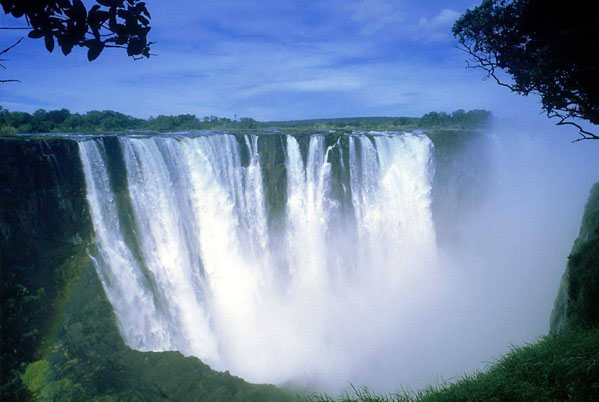
Victoria Falls
Located in the Zambezi River middle reaches,is one of the world's three waterfalls, the famous tourist attraction, one of the world's seven natural wonders. It is a waterfall group, maximum width of 16.9 meters, the highest point of 108 meters, the average annual flow of about 934 cubic meters/second.The great falls is composed of five nearly hundred meter big waterfalls.The wide Zambezi River runs eastwards but suddenly it turns backwards at Livingstone in front of high mountains and deep valleys. Then the river goes forwards as if thousands of horses gallop and arrives pouring down at the bottom of the valleys as if the mountains fall down and the sea waves roll over. The sound of the river spreads tens of miles away and the drops of the river spatter everywhere, flying hundreds of meters high. How splendid that spectacular is!
Kafue National Park
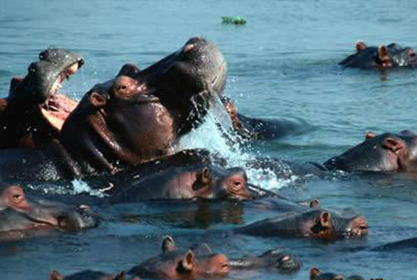
There are 19 national parks in Zambia, Kafue National Park which covers an lagrest area of the rich variety of wild animals, there are bison, antelope, deer, zebra and other baboons, lions and leopards are also often come and go. There are 600 kinds of birds. It is also famous for the beautiful flowers and trees.
Lake Kariba
Zambia has established Kariba hydropower station on one side of Zambezi River in 1938,form a huge Kariba dam,127 meters height,12 meters width road dam, storage capacity of 200 trillion cubic l, is the world's largest artificial lake Kariba.Kariba lake is 282km long, maximum width of 32km with a total area of 2,000 square miles.
EXPLORE
RELATED WEBSITE